
Standing at Khunjerab Pass feels like standing at the edge of the world. Not because you’ve run out of places to go; China continues just beyond the monument marking the border, but because at 4,693 meters, the atmosphere is thin enough that your body feels the altitude before your mind processes the geography. The sky is a shade of blue that doesn’t exist at sea level. The silence is absolute. And the mountains surrounding you are part of the Karakoram’s highest and most dramatic terrain.
Khunjerab Pass in Pakistan is simultaneously one of the country’s most accessible extreme experiences and one of its most genuinely extraordinary. The Karakoram Highway, one of the world’s great engineering achievements, delivers you to 4,693 meters by tarmac road, eliminating the weeks of trekking that reaching comparable altitude would otherwise require. Yet arriving there by road doesn’t diminish the experience. The altitude is real, the border is real, the cold is real, and the mountains surrounding you are as indifferent to human presence as any summit reached by mountaineers after days of effort.
This comprehensive Khunjerab Pass Travel Guide covers everything you need to know to visit this remarkable place, from logistics and timing to what to expect physiologically and how to make the most of what the pass and the journey to it offer.
What Is Khunjerab Pass?
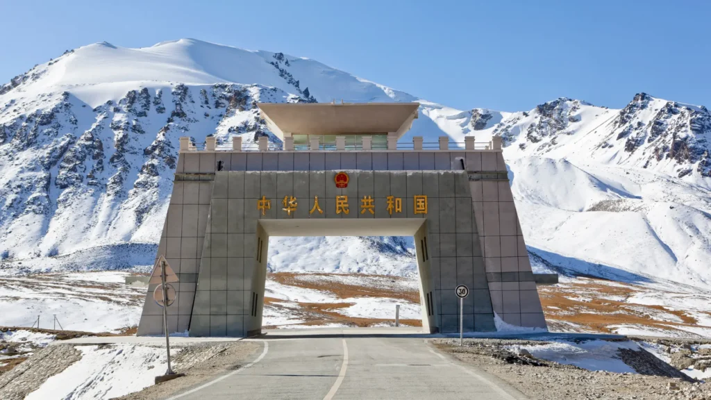
Khunjerab Pass is a high mountain pass in the Karakoram Range. It marks the border between Pakistan’s Gilgit-Baltistan province and China’s Xinjiang region. The pass sits at the highest point of the Karakoram Highway, the road that links Pakistan and China. Workers spent nearly twenty years building this road through some of the world’s toughest terrain.
The name Khunjerab comes from the Wakhi language spoken in this part of Gilgit-Baltistan. “Khun” means blood, and “jerab” refers to a stream or creek fed by a spring or waterfall. Put together, most historians translate it as “Valley of Blood.” The name is not about the water’s color. It comes from the toll the pass took on travelers. Old accounts from herders and explorers describe Khunjerab as a route littered with the remains of animals and people who died attempting the crossing before roads, shelter, or rescue were available at this altitude. Some sources note the meaning is debated, with a few tracing “jerab” to a slightly different root and suggesting the name could mean “Valley of the Khan” instead. But the blood reference, tied to death and danger rather than mineral runoff, is the one supported by most historical and linguistic sources.
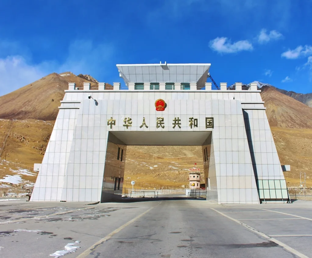
The pass serves as an active international border crossing between Pakistan and China, though tourist access is subject to specific regulations that differ from commercial crossing protocols. A monument marks the exact border point, and border guards from both countries maintain a presence at this remote high-altitude crossing.
Khunjerab Pass sits at 4,693 meters (15,397 feet) above sea level, making it one of the world’s highest international border crossings accessible by paved road. Only a handful of comparable crossings exist globally.
Khunjerab Pass height places it above the altitude base camps of many Himalayan and Karakoram peaks, higher than most visitors to mountain destinations ever reach, and in physiological territory where acclimatization genuinely matters.
Where Is Khunjerab Pass Located?
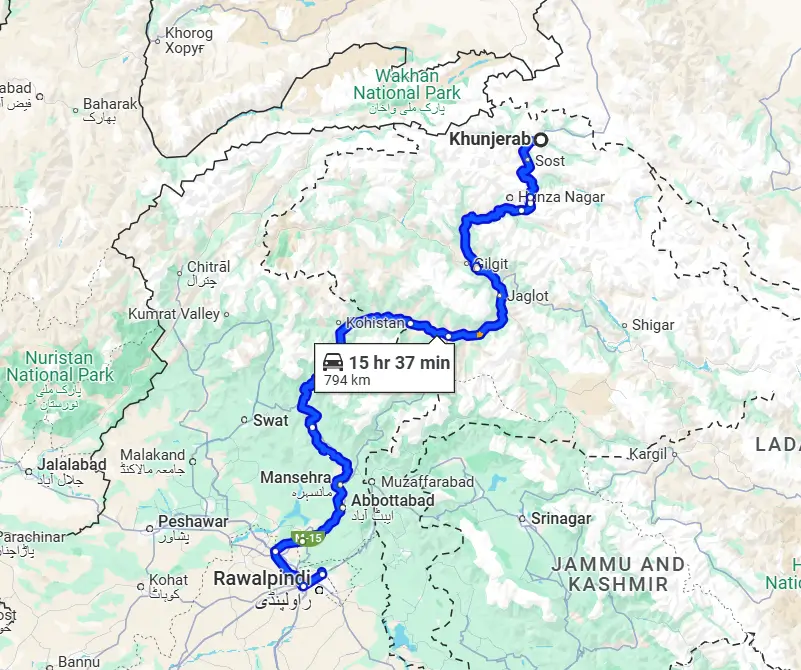
Khunjerab Pass’s location places it at the northern terminus of Pakistan’s Karakoram Highway, approximately:
- 230 kilometers from Gilgit city
- 135 kilometers from Karimabad (Hunza)
- 85 kilometers from Sost (the last Pakistani town before the pass)
- 15 kilometers from Dih (the last significant point before the Pakistani border post)
Geographic coordinates: Approximately 36.8474° N, 75.4292° E
Administrative position: The pass marks the boundary between Pakistan’s Gilgit-Baltistan and China’s Xinjiang Autonomous Region. On the Pakistani side, it falls within Khunjerab National Park, while the Chinese side extends into Taxkorgan Tajik Autonomous County of Xinjiang.
Khunjerab Pass Hunza connection: The pass is commonly marketed as part of Hunza tours because Hunza is the primary base for most tourists traveling north. However, the pass is actually considerably north of Hunza Valley proper; travelers pass through the Gojal region of upper Hunza (including Passu and Sost) before reaching the pass area.
Why Is Khunjerab Pass Famous?
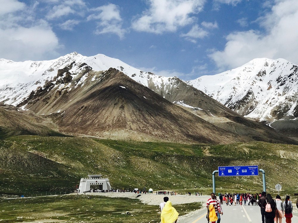
Several distinct factors combine to make Khunjerab Pass one of Pakistan’s most compelling destinations:
The altitude record: At 4,693 meters, Khunjerab is the world’s highest paved international border crossing. This distinction alone draws travelers motivated by “highest,” “first,” or “most extreme” experiences, legitimate motivations that the pass delivers on completely.
The Pakistan-China border: Standing at the Pakistan-China border in this remote, high-altitude location creates a psychological impact that more conventional border crossings don’t. This isn’t an airport departure lounge or a highway checkpoint; it’s a mountain pass where two nuclear powers share a boundary at nearly 5,000 meters elevation.
The Karakoram Highway itself: The KKH is arguably the world’s most dramatic highway, traversing some of the most challenging terrain on earth. Driving its full length to Khunjerab is a journey that rewards with views that continually compete for supremacy. The pass represents the ultimate destination of this extraordinary road.
Khunjerab National Park: The protected area encompassing the pass region is home to rare wildlife, including Marco Polo Sheep (Ovis ammon polii), one of the world’s largest wild sheep with massive, curving horns; Snow Leopard; Himalayan Ibex; Tibetan Wolf; and numerous high-altitude bird species. Wildlife sightings, particularly of Marco Polo Sheep, are realistic rather than merely hopeful.
The landscape: High-altitude plateau landscape of barren, alien beauty, rolling terrain above treeline where the scale of surrounding mountains becomes suddenly comprehensible because you’ve eliminated the valley-floor perspective that normally compresses them.
Photography: The combination of border monument, dramatic mountains, high-altitude plateau light, and potential wildlife encounters creates photography opportunities impossible to replicate elsewhere in Pakistan.
How to Reach Khunjerab Pass
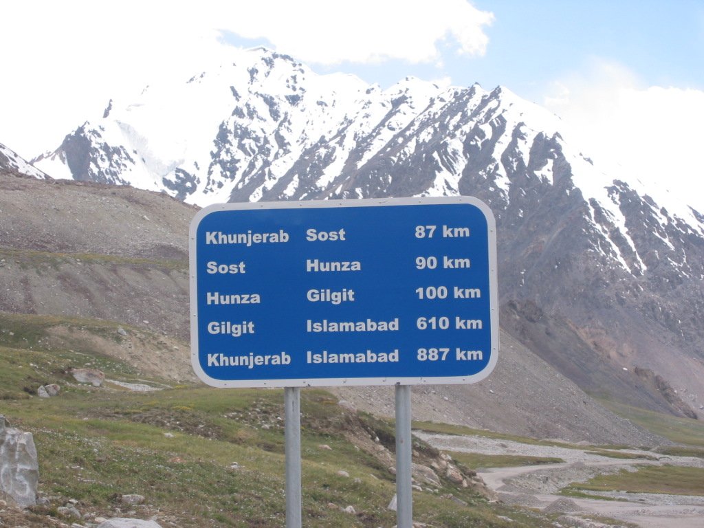
From Karimabad (Hunza) to Khunjerab
Distance: Approximately 135 kilometers
Time: 3-3.5 hours
Route: Karimabad → Karakoram Highway (northbound) → Gulmit → Passu → Sost → Dih → Khunjerab Pass
Stage breakdown:
Karimabad to Passu (110 km, 2-2.5 hours): First section passing through Attabad Lake, Gulmit, with Passu Cones providing dramatic scenery.
Passu to Sost (30 km, 30-45 minutes): The landscape becomes increasingly arid and dramatic as you approach Sost, the last town with significant services before the pass.
Sost to Khunjerab Pass (55 km, 1-1.5 hours): This final section is the most dramatic; the highway climbs steadily through increasingly barren terrain, crossing small streams, passing through Dih village, and ascending steadily toward the pass plateau.
From Gilgit
Distance: Approximately 230 kilometers
Time: 4.5-5.5 hours
Route: Gilgit → Karakoram Highway northbound → Hunza → continue as above
From Islamabad
Most practical approach:
- Fly Islamabad to Gilgit (PIA, 45 minutes, weather permitting)
- Drive Gilgit to Khunjerab (4.5-5.5 hours)
- Total: approximately 6-7 hours on flight days
Road-only approach:
- Islamabad to Khunjerab: Approximately 700+ kilometers, 14-16 hours driving
- Most visitors break this into a 2-day journey, overnighting in Chilas or Gilgit
Vehicle Requirements
The Karakoram Highway to Khunjerab is paved throughout, but the high altitude, potential for sudden weather changes, and remote location make vehicle selection important:
Regular cars: Technically sufficient for the paved road in good weather conditions. Many tourists complete this journey in standard vehicles.
4×4 strongly recommended: For flexibility to stop at viewpoints, handle unexpected weather changes, and provide psychological security at high altitude and in remote terrain. Most tour operators use 4×4 vehicles for this route.
Engine considerations: Petrol engines lose significant power at 4,693 meters due to reduced oxygen. Ensure the vehicle is mechanically sound before attempting; breakdowns at high altitude in remote terrain are serious situations.
Registration Requirements
Pakistani tourists: No special permits currently required for Pakistani nationals visiting Khunjerab Pass up to the border monument.
Foreign tourists: International visitors need to register at the Sost dry port checkpoint before proceeding to the pass. Tour operators handle this paperwork routinely; ensure your tour package includes this registration.
Important clarification: Can tourists visit Khunjerab Pass? Yes, tourists from Pakistan and international visitors can visit the Pakistani side of the pass, including the border monument. Crossing into China requires a valid Chinese visa, separate arrangements, and health documentation as per current requirements.
Best Time to Visit Khunjerab Pass
Khunjerab Pass Opening
Khunjerab Pass opening for tourist traffic follows a seasonal schedule driven by weather and snow conditions:
Typical opening: May 1st (though actual opening depends on snow clearance and can be delayed)
Typical closing: October 31st or earlier if early snowfall occurs
2026 Schedule: The Pakistan-China border gate at Khunjerab follows Pakistani government announcements. Verify current opening status with the Gilgit-Baltistan Tourism Department or reputable tour operators before finalizing plans.
Season-by-Season Analysis
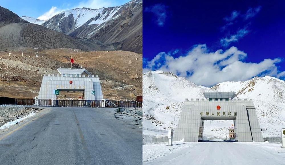
May (Early Season): The pass has typically just opened; snow may still line the roadside at higher elevations, creating dramatic scenery. Temperatures are cold (2-10°C at the pass) but manageable. Tourist numbers are minimal, providing peaceful access. The road is open, but road conditions should be verified as late snowfall can temporarily close sections.
June-July (Building Season): Snow clears progressively, temperatures become slightly warmer (by 5-15°C at the pass), and tourist traffic increases. The landscape transitions from winter’s stark white to summer’s brown plateau with wildflower patches at lower elevations. Good all-round visiting conditions.
August (Peak Season): Maximum tourist traffic and optimal weather for most visitors. The Marco Polo Sheep are typically at their most visible during summer grazing. Temperatures are as warm as they get at the pass (8-18°C at midday)—the best balance of accessibility and natural beauty.
September-October (Ideal Window): Many experienced travelers consider this the best time to visit Khunjerab Pass. Post-monsoon clarity delivers extraordinary atmospheric transparency; mountains appear sharper, colors more saturated. Temperatures cool but remain manageable (0-12°C). Tourist numbers decline significantly. The pass typically remains open through October, but confirm conditions, as closures can advance in heavy snowfall years.
November-April (Closed): The pass closes to tourist traffic, typically from November 1st through April 30th, due to heavy snowfall making the road impassable and conditions at the pass genuinely dangerous.
Khunjerab Pass Weather
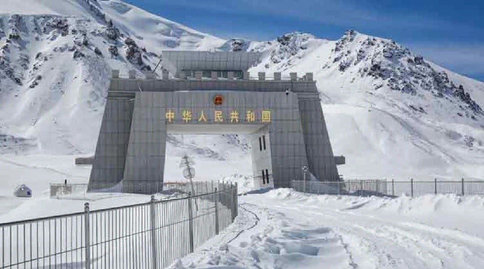
Understanding Khunjerab Pass weather prevents the uncomfortable surprises that ruin otherwise well-planned high-altitude visits:
Temperature realities:
Month Day (°C) Night (°C) Conditions
May 2-10 -5 to 0 Cold, some snow possible
June 5-15 -2 to 5 Improving, mostly clear
July 8-18 0-8 Best daytime temperatures
August 8-18 0-8 Peak season, occasional cloud
September 3-12 -5 to 3 Cooling, exceptional clarity
October -2 to 8 -10 to -2 Cold, possible early snow
Wind: The pass is exposed, and wind can be ferocious regardless of season. Wind chill can push apparent temperatures well below air temperature; a 10°C day can feel like -5°C in strong wind. Windproof layers are non-negotiable.
Sun intensity: At nearly 5,000 meters, UV radiation is intense. The combination of thin atmosphere and potential snow reflection creates burning conditions. Sunscreen and UV-protective sunglasses are essential.
Sudden changes: Mountain weather at this altitude can change from clear to storm conditions within an hour. Monitor conditions and be prepared to descend if weather deteriorates.
Altitude effects: The reduced oxygen at 4,693 meters affects everyone to some degree. Headache, breathlessness, and fatigue are normal; severe symptoms (confusion, loss of coordination, chest tightness) require immediate descent.
Also Read: Top 20 Coldest Places in Pakistan
Khunjerab Pass Road Conditions
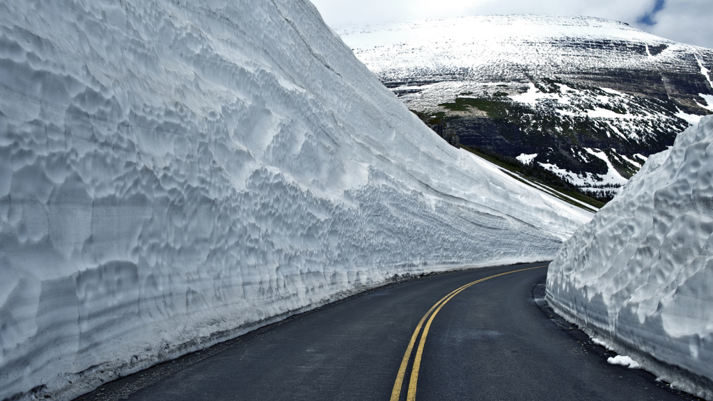
Khunjerab Pass road conditions vary significantly by season and recent weather:
Normal conditions (June-September): The Karakoram Highway between Sost and Khunjerab is generally in reasonable condition, with a paved surface and some deteriorated sections, well-maintained relative to its extreme terrain, and navigable by vehicles in good mechanical condition.
Post-rain conditions: Heavy rain can trigger small landslides and rockfall anywhere along the KKH. The road authority (NHA) clears major blockages relatively quickly, but delays of several hours are possible after significant precipitation.
Early season (May): Snowmelt creates road surface issues; sections can be wet, icy at higher elevations in the morning, and occasionally partially blocked by late snow. Drive cautiously, and later in the morning, when the ice has melted.
Late season (October): Early snowfall can create icy sections, particularly above 4,000 meters. Snow chains or 4×4 with appropriate tires are recommended.
Landslide zones: Several sections of the KKH are known landslide-prone areas. Local drivers know these sections and navigate appropriately; another reason hiring local drivers is recommended over self-driving unfamiliar routes.
Practical recommendations:
- Start from Sost no later than 8:00-9:00 AM to allow a comfortable round trip with time at the pass
- Carry basic emergency supplies (water, food, warm clothing, first aid)
- Inform your accommodation of departure time and expected return
- Check with Sost locals about current road conditions before proceeding
Things to Do at Khunjerab Pass
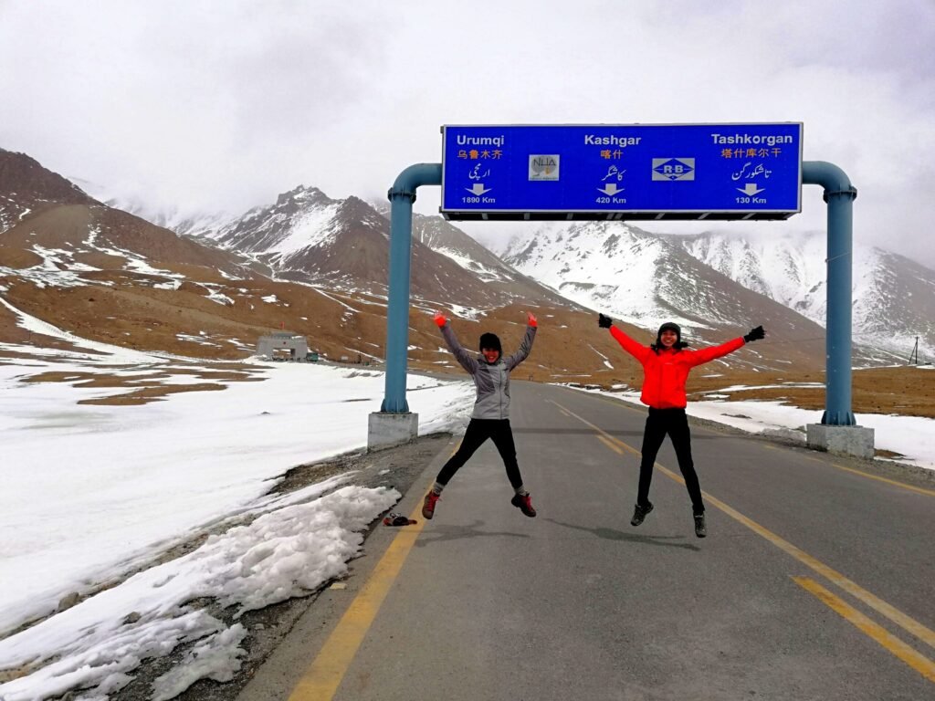
Stand at the Pakistan-China Border Monument
The primary reason most visitors come, the official border monument marking the Pakistan-China boundary provides the iconic photograph that validates the journey. Taking your photo at the monument, looking into China from Pakistan (or Pakistan from China’s direction), and simply absorbing the reality of your location is the core Khunjerab experience.
Wildlife Watching for Marco Polo Sheep
Khunjerab National Park is the primary Pakistani habitat for Marco Polo Sheep, enormous wild sheep with legendary spiral horns that can reach 190cm in span. These are not background wildlife you might glimpse through binoculars; Marco Polo Sheep are often visible at relatively close range from the highway, particularly in early morning and late afternoon. Bring binoculars but don’t be surprised if a group appears within 100 meters of your vehicle.
Snow Leopard sightings are extremely rare, but the pass region is genuine snow leopard habitat; tracker evidence confirms their presence even when sightings don’t occur.
High-Altitude Photography
The combination of the border monument, dramatic mountain skylines, potential wildlife encounters, plateau landscape, and extraordinary light quality makes the pass one of Pakistan’s most rewarding locations for photography. The challenge is altitude; manual tasks become more difficult at reduced oxygen levels, and cold-shivering hands complicate precise camera operation. Allow more time than you’d normally need.
Experience True High Altitude
For many visitors, Khunjerab Pass is the highest altitude they’ll ever reach, higher than many mountain base camps, higher than most peaks accessible to non-mountaineers globally. Simply being there, breathing the thin air deliberately, feeling your body work harder than usual, and appreciating the physiological reality of altitude is a worthwhile experience in itself.
Explore the Plateau Landscape
The immediate pass area opens onto a rolling high-altitude plateau quite different from the dramatic gorge landscape that characterizes most of the KKH. The plateau’s openness after hours of narrow valley driving creates a landscape shift worth exploring. Short walks from the road (without elevation gain) offer different perspectives on the surrounding peaks.
Also Read: Passu Cones Travel Guide
Places to Visit on the Way
The journey to Khunjerab from Hunza passes through extraordinary terrain with several destinations worth stopping for:
Attabad Lake
The spectacular turquoise lake created by the 2010 landslide dam, located approximately 30 kilometers north of Karimabad. Boat tours available. The lake’s impossible blue color against the surrounding mountain landscape creates one of Pakistan’s most photogenic locations. Allow 30-45 minutes.
Gulmit Village
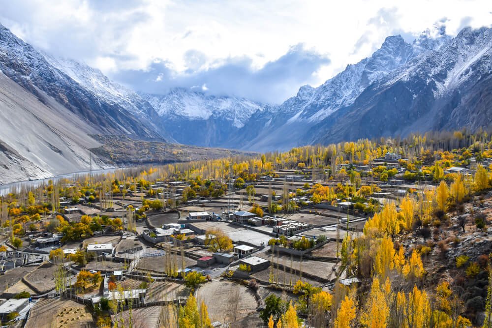
Gojal region’s administrative center with the Hunza Cultural Heritage Museum providing excellent context for the Wakhi culture predominating in upper Hunza. The village’s traditional architecture and orchard landscapes reward brief exploration.
Passu Village and the Cones
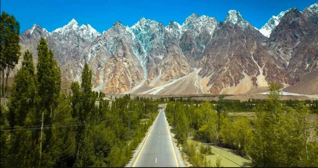
The extraordinary Passu Cones formation is visible from the highway throughout the Passu area. Stop for the Hussaini Suspension Bridge experience and multiple viewpoints of the Cones. Allow 1-2 hours minimum, longer if crossing the bridge.
Batura Glacier Viewpoint
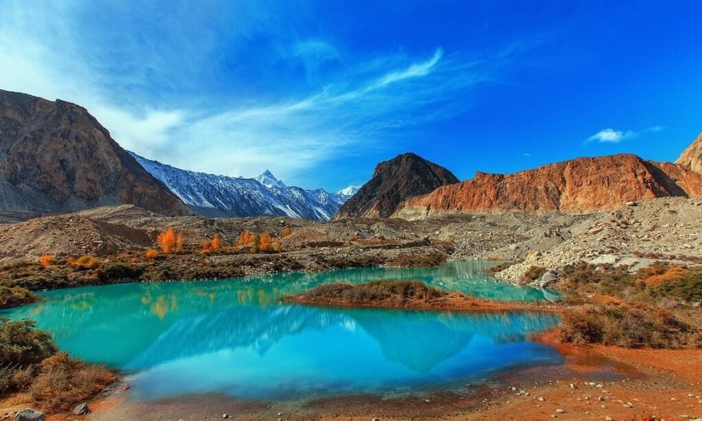
The Batura Glacier, one of the world’s longest glaciers outside polar regions, is visible from various points on the highway north of Passu. Pull-off points allow photography of this massive ice stream.
Sost (Last Pakistani Town)
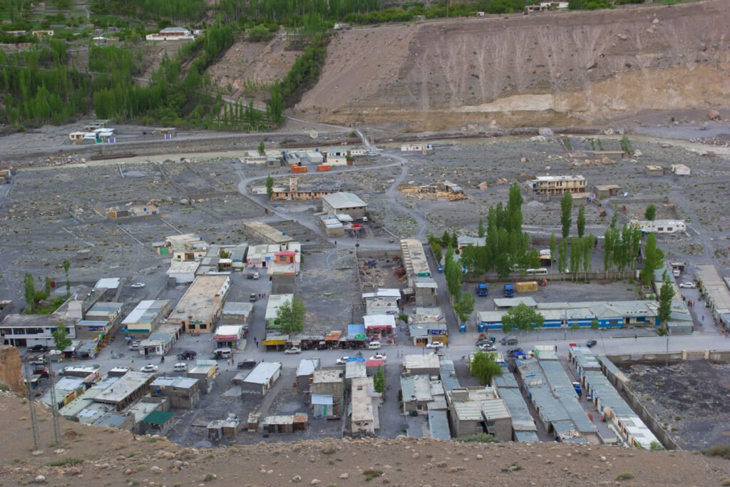
The Sost dry port and checkpoint mark the last significant services before the pass. Essential stop for fuel, food, and registration formalities for international tourists. Sost has several restaurants and basic accommodation for those making a two-day excursion to Khunjerab.
Dih Village
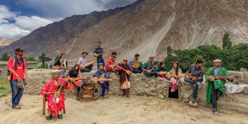
The last village before the Pakistani border post, a small Wakhi community at high altitude whose residents live an extraordinary daily life at elevations most people visit briefly and deliberately.
Khunjerab National Park
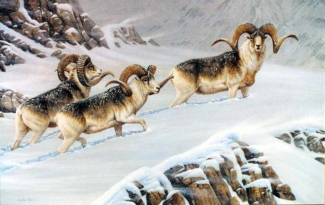
Khunjerab National Park was established in 1975 specifically to protect the endangered Marco Polo Sheep population and the broader high-altitude ecosystem of Pakistan’s extreme northern frontier.
Coverage: The park encompasses approximately 2,270 square kilometers of high-altitude terrain above 3,000 meters, including the pass itself, surrounding valleys, and connecting ridges.
Wildlife protected:
- Marco Polo Sheep (Ovis ammon polii): The park’s signature species, globally endangered with a significant population here
- Snow Leopard: The park maintains a viable snow leopard population, confirmed by camera trap evidence
- Himalayan Ibex: Frequently visible on cliff faces throughout the park
- Tibetan Wolf: Present but rarely seen
- Brown Bear: Occasional presence in lower park areas
- Golden Eagle: Regularly visible soaring above the plateau
- Various high-altitude bird species: Himalayan Snowcock, Tibetan Snowfinch, various accentors
Park regulations: No hunting, no disturbance of wildlife, no collection of plants or rocks. Stay on designated routes. Photography of wildlife is encouraged, but maintain appropriate distances.
Entry fees: A nominal fee is typically collected at the Sost checkpoint or Dih area for park entry. Tour operators include this in package costs.
Wildlife photography tips: Early morning (first 1-2 hours after dawn) and late afternoon (final 2 hours before dark) offer the best wildlife activity. Binoculars transform the experience; Marco Polo Sheep visible at a distance without binoculars becomes magnificently detailed with them.
Khunjerab Pass Travel Cost
Independent Travel Estimates
Expense Cost (PKR)
Transport Karimabad to Khunjerab (hired car) 12,000-18,000
Fuel (if self-driving) 5,000-8,000
Sost accommodation (if 2-day trip) 2,000-4,000
Meals for day trip 1,500-3,000
National park entry fee 500-1,000
Guide (recommended) 2,000-3,000
Miscellaneous 1,000-2,000
Total per person (2-3 people sharing car) 9,000-16,000
Tour Package Costs
Day trip to Khunjerab as part of a Hunza package: Typically included in comprehensive Hunza tour packages costing PKR 40,000-80,000 for multi-day tours that include accommodation and all transport.
Dedicated Khunjerab day trip from Karimabad: PKR 18,000-25,000 per person in organized tour format including transport, guide, and park fees.
Travel Tips for Khunjerab Pass
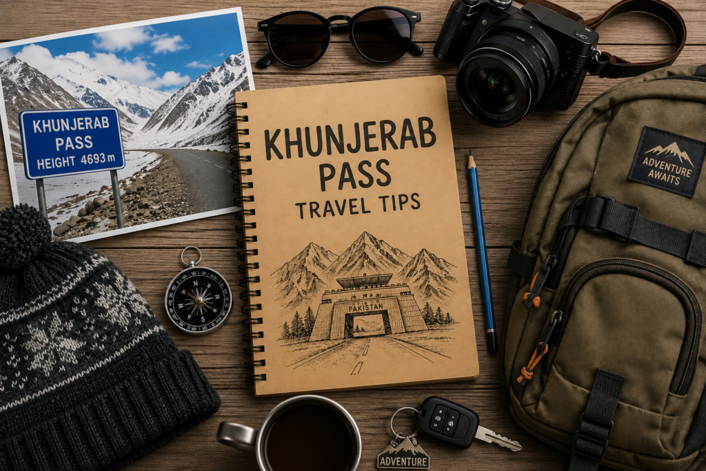
Acclimatize before attempting: Don’t drive directly from Islamabad to Khunjerab in a single day. Spend at least one night at Gilgit (1,500 meters) and one at Karimabad (2,400 meters) before attempting 4,693 meters. Proper acclimatization dramatically reduces the risk of altitude sickness.
Depart early: Leave your base by 7:00-8:00 AM to allow for comfortable driving time, time at the pass, and a safe return before dark. High-altitude driving after dark is inadvisable.
Layer clothing thoroughly: Even in July-August, temperatures at the pass can be cold, and the wind makes it colder. Bring:
- Thermal base layer
- Insulating mid-layer (fleece or down)
- Windproof/waterproof outer layer
- Warm hat, gloves, neck gaiter
- These layers come off if you get too warm; if you don’t have them, nothing substitutes
Stay hydrated: Altitude increases fluid loss through respiration. Drink more water than feels necessary; dehydration worsens altitude effects dramatically.
Don’t over-exert: At nearly 5,000 meters, walking quickly, carrying heavy bags, or climbing any elevation triggers breathlessness that feels alarming. Move slowly and deliberately. There’s no rush at Khunjerab; the monument will wait.
Carry altitude sickness medication: Diamox (acetazolamide) can be prescribed by doctors for altitude sickness prevention. Discuss with your physician before travel.
Sunscreen is essential: UV radiation at high altitude is intense enough to cause serious sunburn in a surprisingly short time. SPF 50+ on all exposed skin.
Download offline maps: Signal is unreliable or absent along the upper KKH.
Inform others of your itinerary: Tell your accommodation provider your departure time and expected return time. Remote mountain travel requires someone knowing where you are.
Also Read: Babusar Pass (Babusar Top): Complete Travel Guide, Route & Best Time to Visit
Frequently Asked Questions
Khunjerab Pass altitude is 4,693 meters (15,397 feet) above sea level. This makes it one of the world’s highest paved international border crossings and the highest point of the Karakoram Highway. At this elevation, atmospheric pressure is approximately 57% of sea level, meaning each breath delivers significantly less oxygen than at lower altitudes.
Yes, tourists can visit the Pakistani side of Khunjerab Pass. Pakistani nationals need no special permits. International tourists register at the Sost checkpoint before proceeding; tour operators handle this routinely. Crossing into China requires a valid Chinese visa, current health documentation, and completion of formal border crossing procedures. Simply visiting the border monument on the Pakistani side doesn’t require a Chinese visa.
The drive from Karimabad (Hunza’s tourist hub) to Khunjerab Pass is approximately 135 kilometers and takes 3-3.5 hours by road. The distance means most visitors make this a full-day excursion from Karimabad, leaving early morning and returning by late afternoon.
No. Khunjerab Pass is seasonal. It typically opens on May 1st and closes on October 31st for tourist traffic. Winter closure is due to heavy snowfall making the road impassable and conditions at 4,693 meters genuinely dangerous. Actual opening dates vary by annual weather conditions.
Absolutely yes, for travelers interested in extreme geography, the highest accessible border crossing in the world, extraordinary wildlife (Marco Polo Sheep sightings are realistic), the Karakoram Highway’s ultimate destination, or simply experiences that push personal boundaries in safe, accessible ways. The journey to the pass is as rewarding as the destination; the KKH north of Hunza provides continuous extraordinary scenery.
September is the month many experienced travelers and photographers prefer; post-monsoon atmospheric clarity delivers exceptional visibility, temperatures are cold but manageable, tourist numbers have fallen significantly from the summer peak, and the light quality produces outstanding photographs. August provides the most comfortable temperatures. May-June offers early-season access with fewer visitors but colder conditions.
Children can physically visit the pass, but altitude-related effects require careful management. Children acclimatize differently from adults; some handle altitude very well, others are more affected. Never rush acclimatization for children. Spend proper time at intermediate altitudes (Gilgit, Karimabad) before attempting Khunjerab. Watch carefully for altitude sickness symptoms, which children may not articulate clearly. If a child shows any concerning symptoms, descend immtely.
Book a Hunza & Khunjerab Tour with Eventica Travels
Visiting Khunjerab Pass involves logistics, altitude management, registration formalities, and local knowledge that significantly benefit from experienced tour operator support. Eventica Travels specializes in comprehensive Hunza and Khunjerab tours that handle every detail: transport, accommodation, registration, guides, and the flexibility to adjust plans based on weather and road conditions.
Our guides have driven the KKH to Khunjerab repeatedly across multiple seasons; they know the road’s character, the wildlife watching points, the photography positions, the altitude signs to watch for, and how to make the journey as safe and rewarding as possible.
Featured Khunjerab & Hunza Packages
🏔️ 10 Days Group Tour Hunza & Naltar Valley
Islamabad → Besham → Sumar Nala → Chilas/Goner Farm → Raikot → Jaglot → Nomal → Naltar → Lakes Of Naltar → Hunza Valley → Passu Cones → Attabad Lake → Altit Or Baltit Fort → Royal Garden → Khunjerab Pass → Khanpur Lake
Starting from: Rs 42,500/. (Per Person on Quad Sharing)
🏔️ 12 Days Group Tour Hunza & Skardu Valley
Karimabad → Islamabad → Besham → Sumar Nala → Chilas/Goner Farm → 3 Mountain Junction → Gilgit → Rakaposhi View Point → Hunza Valley → Altit Or Baltit Fort → Royal Garden → Khunjerab Pass (If Accessible) → Astak Nala → Attabad Lake → Passu Cones → Upper & Lower Kachura Lakes → Skardu → Shigar Fort
Starting from: Rs. 55,500/. (Per Person on Quad Sharing Room)
Conclusion: Where Roads End, and Mountains Begin
Khunjerab Pass represents the Karakoram Highway’s ultimate achievement, the point where one of the world’s greatest engineering accomplishments delivers you to the world’s highest paved international border crossing. The journey to get there is extraordinary; the destination itself is beyond the ordinary category.
At 4,693 meters, breathing consciously, looking across the plateau at mountains that dwarf anything in Europe or North America, standing at a border between two of Asia’s great civilizations in a location so remote that most people will never come near it, the experience creates a particular kind of memory. The kind that doesn’t fade.
Pack the layers. Allow the acclimatization time. Start early. Drive carefully. And when you arrive at the border monument, take a moment before the photographs. Stand there and actually feel where you are.
The Karakoram waited billions of years to create Khunjerab Pass. It deserves more than a selfie.
Eventica Travels – Guiding Travelers to Pakistan’s Most Extraordinary Destinations
“The Karakoram Highway ends at 4,693 meters. The memories begin there.”