

Ask anyone who’s hiked Miranjani, and they’ll likely tell you it’s not just about reaching the top, but about every moment you earn along the way. There’s something quietly thrilling about standing on that summit, knowing you made it up there on your own steam. The views? Absolutely worth the effort. But honestly, it’s the journey through that cool, pine-scented forest that really sticks with you.
You’ll find Miranjani in the Galiyat region of Khyber Pakhtunkhwa, not far from Islamabad, just about a 90-kilometer drive. Despite being the highest peak in the area (2,992 meters, or 9,816 feet), it’s surprisingly approachable. No fancy gear or weeks of planning needed; just a decent pair of shoes, a bit of stamina, and maybe some determination.
What hooks people isn’t just the panoramic view at the top, though that’s unforgettable on a clear day. It’s how accessible the trail is, the lively crowd you’ll bump into around Nathia Gali, and that sense of accomplishment you get after a full day outdoors.
For many families in Islamabad, Miranjani is where the hiking bug bites for the first time. More experienced trekkers use it to train, and even they admit it’s more rewarding than expected. International travelers, meanwhile, love that it’s a real mountain adventure—without all the hassle.
In this 2026 guide, you’ll find everything you need: trail tips, seasonal advice (trust me, spring and autumn are unbeatable), where to stay, and what to watch out for—so you can make the most of your Miranjani trek.
Where is Miranjani Peak Located?
Miranjani Peak sits within Ayubia National Park in the Abbottabad District of Khyber Pakhtunkhwa province. The peak rises at the northeastern end of the Galiyat ridge, commanding views over multiple valleys and hill stations.
Geographic coordinates: Approximately 34.0694° N, 73.3917° E
Distance from major cities:
- Islamabad: Approximately 90 kilometers (2-2.5 hours)
- Rawalpindi: Approximately 75 kilometers (1.5-2 hours)
- Abbottabad: Approximately 45 kilometers (1-1.5 hours)
- Murree: Approximately 35 kilometers (1 hour)
The peak’s position within Ayubia National Park means the entire trail passes through protected forest, a designation that has preserved the extraordinary biodiversity and pristine forest character that makes this trek so enjoyable.
Why Miranjani Peak is Famous
Miranjani’s fame rests on several genuine attributes rather than marketing hype:
Highest peak in Galiyat: The summit distinction creates a real sense of achievement that lower trails in the same region can’t deliver.
Accessibility from Islamabad: Very few genuine mountain experiences sit this close to Pakistan’s capital. Weekend trekking without multi-day travel is genuinely possible.
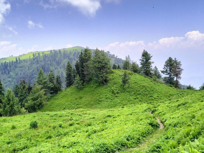
Forest quality: The oak, pine, and rhododendron forests of Ayubia National Park through which the trail passes represent some of the finest preserved mountain forest in northern Pakistan.
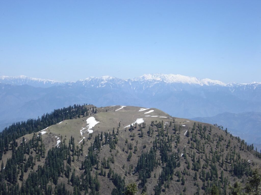
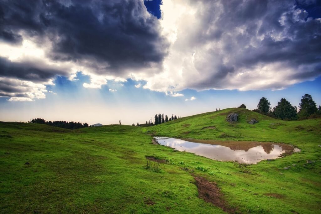
360-degree summit views: On clear days, the summit delivers views of Nanga Parbat (over 160 km away, visible only on exceptionally clear days), the Western Himalayan ranges, Kashmir, and the valleys stretching toward Islamabad—a panorama that rewards every uphill step.
Diverse wildlife: The protected status of Ayubia National Park means animal and bird sightings are realistic rather than merely hopeful.
Year-round accessibility: Unlike many Pakistani peaks that close for winter, Miranjani can be attempted in every season, though winter requires proper gear and caution due to snow and ice.
Quick Facts About Miranjani Peak
| Detail | Information |
| Elevation | 2,992 meters (9,816 feet) |
| Location | Ayubia National Park, Abbottabad District, KPK |
| Trek Distance | 8-10 km round trip |
| Trek Duration | 4-6 hours round trip |
| Difficulty Level | Moderate |
| Starting Point | Nathia Gali (various trail heads) |
| Forest Type | Oak, Pine, Rhododendron |
| Best Season | April-June, September-November |
| Nearest City | Abbottabad (45 km) |
| From Islamabad | 90 km (2-2.5 hours) |
| Wildlife | Leopards, Himalayan Black Bear, 130+ bird species |
| National Park | Ayubia National Park |
How to Reach Miranjani Peak from Islamabad
Getting to Nathia Gali
The standard approach begins in Nathia Gali, the charming hill station that serves as the most convenient base for Miranjani trekking. Several route options exist from Islamabad:
Most common route (recommended): Islamabad → Murree (via Murree Expressway) → Barian → Dungagali → Nathia Gali
This route takes approximately 2-2.5 hours under normal traffic conditions and offers beautiful views throughout, particularly from Murree onward.
Alternative route via Abbottabad: Islamabad → Havelian → Abbottabad → Nathia Gali
This route is slightly longer in distance but avoids Murree’s weekend traffic congestion, which can add 1-2 hours during peak seasons.
Transport options:
Private vehicle: Most convenient for families and groups. Free parking is available in Nathia Gali bazaar area and near trail heads.
Public transport: Buses run regularly from Rawalpindi’s Pirwadhai terminal to Murree (PKR 250-400 per person, 2-2.5 hours), where you can transfer to local transport or a taxi for the final segment to Nathia Gali (additional 45–60 minutes). Direct buses to Nathia Gali are infrequent.
Hired transport: Various apps and private taxi services offer Islamabad-Nathia Gali transfers (PKR 3,000-5,000 round trip, depending on vehicle type).
Important parking note: Nathia Gali becomes extremely congested on summer weekends. Arriving before 8:00 AM secures parking without difficulty. Arriving after 11:00 AM on weekends means potentially circling for 30+ minutes.
Miranjani Trek Starting Point
The primary trail head begins near the Nathia Gali bazaar, with signposting that has improved significantly in recent years (though carrying a detailed map or GPS track remains advisable). A Wildlife Department check post marks the official park entrance where trekkers register before proceeding, this registration is mandatory and serves both safety and conservation purposes.
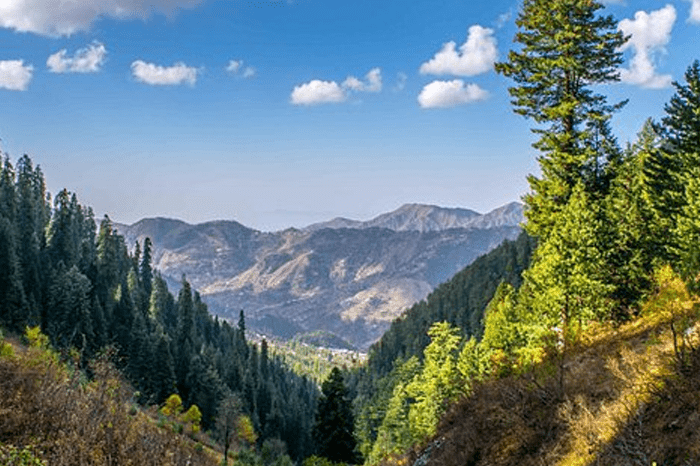
Miranjani Trek Route Overview
The Miranjani trail follows a logical progression from Nathia Gali’s bazaar elevation upward through increasingly dense forest before breaking onto the ridge leading to the summit. The route is essentially linear; you follow the ridge upward, reach the summit, and return the same way.
Trail progression:
Stage 1: Nathia Gali to Park Entrance (0.5 km) Short walk through bazaar to the Wildlife Department check post. Register here. Trail fee payment occurs at this point.
Stage 2: Check Post to Forest Zone (1.5 km) Initial trail section through mixed vegetation with gradual elevation gain. This section is the most social part of the hike, you’ll encounter other trekkers, families doing shorter walks, and the general activity of the park entrance zone.
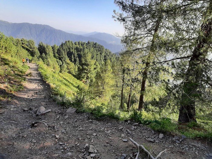
Stage 3: Forest Zone to Ridge (2.5 km) Trail enters proper forest, dense, atmospheric, and significantly cooler than the bazaar area. Elevation gain becomes more consistent. The forest here is the ecological heart of Ayubia National Park and the reason the trail feels like genuine wilderness rather than a developed path.
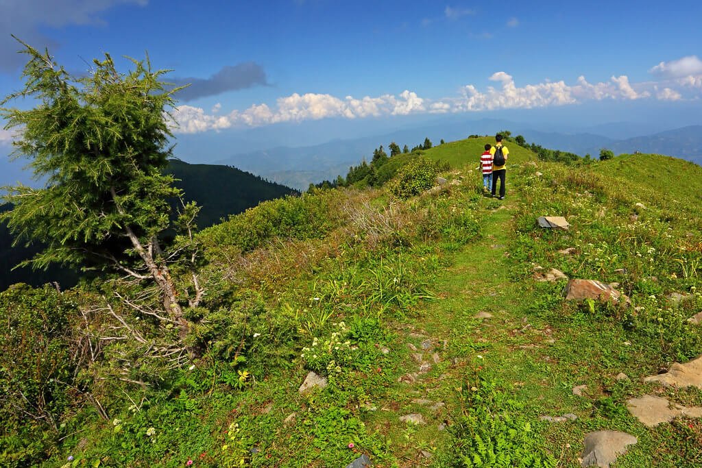
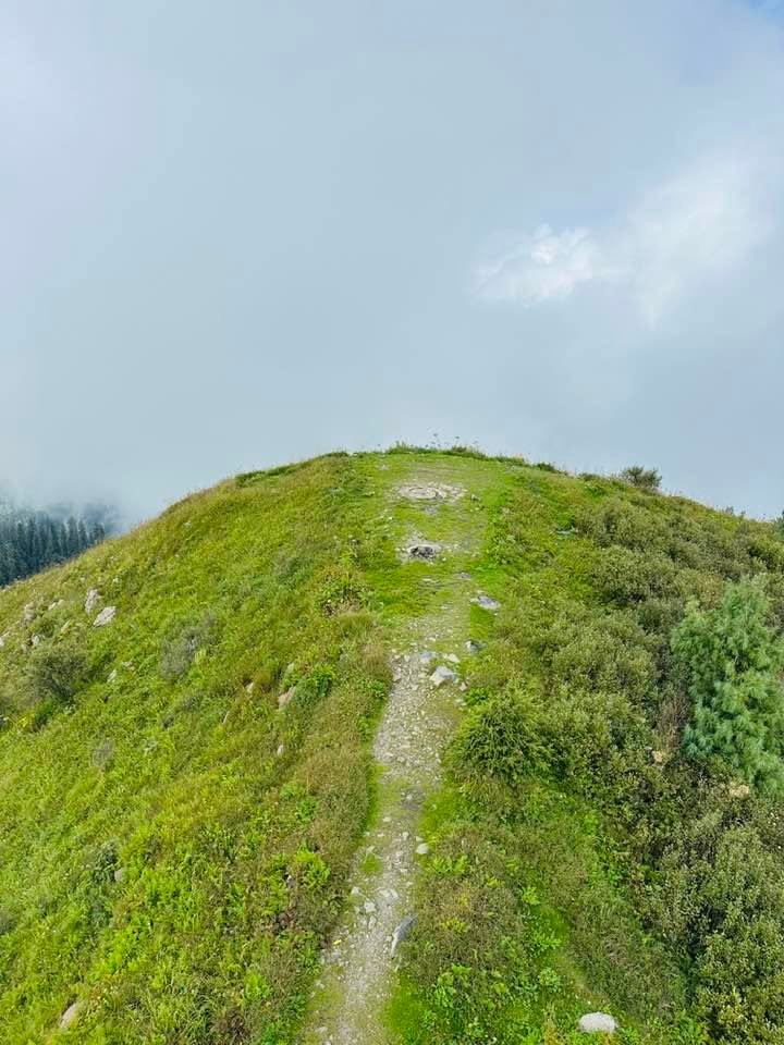
Stage 4: Ridge to Summit (1.5 km) Once on the ridge, the summit becomes visible and the trail character changes, more exposed, broader views even before the summit, and the particular psychological boost that comes from seeing your destination.
Total distance: Approximately 5–6 km one way (10–12 km round trip), with an elevation gain of about 600–700 meters from Nathia Gali to the summit.
Trail Distance and Duration
One way: 5–6 kilometers
Round trip: 10–12 kilometers
Elevation gain: 600–700 meters
Ascent time: 2–3 hours for experienced hikers; 2.5–3.5 hours for average pace
Descent time: 1.5–2 hours
Total round trip: 4–6 hours
These times assume a moderate pace with brief rest stops. Strong hikers with trail experience complete ascents in under 2 hours. Families with children should budget 4-5 hours for ascent alone and plan accordingly.
Miranjani Trek Difficulty Level
Miranjani rates as moderately difficult, genuinely accessible to people without specialized trekking experience while still providing enough challenge to feel earned rather than trivial.
What makes it moderate (not easy):
- Consistent elevation gain throughout (approximately 600–700 meters from Nathia Gali)
- Some steeper sections requiring deliberate foot placement
- Trail length requires sustained effort
- Altitude effects mildly noticeable for lowland residents
What keeps it accessible (not difficult):
- No technical terrain requiring ropes, scrambling, or mountaineering skills
- Well-defined trail with good visibility
- Multiple rest points along the route
- Accessible emergency exit options if conditions deteriorate
Fitness baseline: Someone who exercises regularly and can walk briskly for 2 hours without exhaustion should handle Miranjani comfortably with proper preparation. Complete beginners without any fitness base will find it challenging but achievable with appropriate pacing and rest.
What to Expect Along the Trail
Honestly, the trail surprises most people. First-time visitors expect a straightforward forest walk with a viewpoint at the end. What they actually experience is considerably richer.
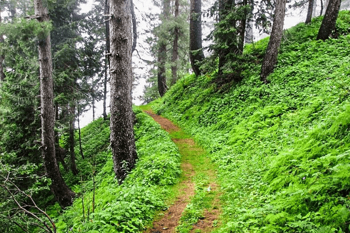
The forest through which the trail passes feels different from distance-visible forests. You’re inside the ecosystem, bird calls from multiple directions, occasional rustle of wildlife in undergrowth, the particular smell of decaying leaves mixed with pine resin, temperature drops as you gain elevation and tree canopy density increases.
The trail itself has personality. Some sections feel like walking through tunnels of rhododendron branches. Others open onto rocky outcrops with sudden valley views. The consistent character is shade, even in summer, the trail remains cool enough for comfortable hiking while sun beats the hillsides on either side.
Physical sensations worth noting: legs begin feeling the sustained uphill by the second kilometer. By the midpoint, lungs are working noticeably harder. Neither sensation is overwhelming, but both confirm you’re making genuine effort. The summit view pays back that effort with considerable interest.
Flora and Fauna of Ayubia National Park

Ayubia National Park’s ecological significance is genuine and worth understanding before you walk through it, knowing what you might encounter enriches the experience considerably.
Flora:
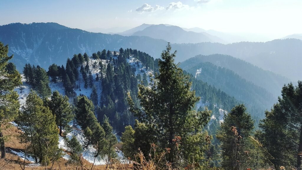
The park supports distinct vegetation communities at different elevations. Lower zones feature mixed broadleaf forest dominated by various oak species (Quercus leucotricophora, Q. dilatata) creating dense canopy that supports extraordinary understorey diversity.
As elevation increases, conifers become more prominent, blue pine (Pinus wallichiana) creates the characteristic tall forest with open understorey that provides some of the trail’s most atmospheric sections.
Rhododendron (Rhododendron arboreum) flowers spectacularly in March-April, transforming sections of trail into tunnels of red and pink blooms that justify visiting solely for this phenomenon.
Medicinal plants are abundant and recognized by local communities, species of traditional medicine value including Berberis species, Aconitum, and various Himalayan medicinal herbs.
Fauna:
The park’s protected status has enabled wildlife populations to recover to levels that make animal encounters realistic rather than merely hopeful.
Leopard: Present but rarely seen, occasionally providing track evidence. The park maintains a viable leopard population, as confirmed by recent conservation surveys (2022).
Himalayan Black Bear: More commonly encountered than leopards. Early morning and late afternoon movement along the ridge below the summit area means hikers occasionally observe bears at distance. Bears should be given space and not approached.
Barking Deer (Muntjac): More commonly heard than seen, the distinctive alarm bark is a characteristic sound of the Ayubia forest.
Yellow-throated Marten: Active during daylight, occasionally visible crossing the trail.
Birds: The park supports over 200 recorded bird species. Highlights include Koklass Pheasant, Kalij Pheasant, various woodpeckers (including Himalayan Woodpecker), numerous warblers, and raptors using ridge thermals. Early morning hikers encounter the richest bird activity.
Also Read: Best Tourist Places to Visit in Murree
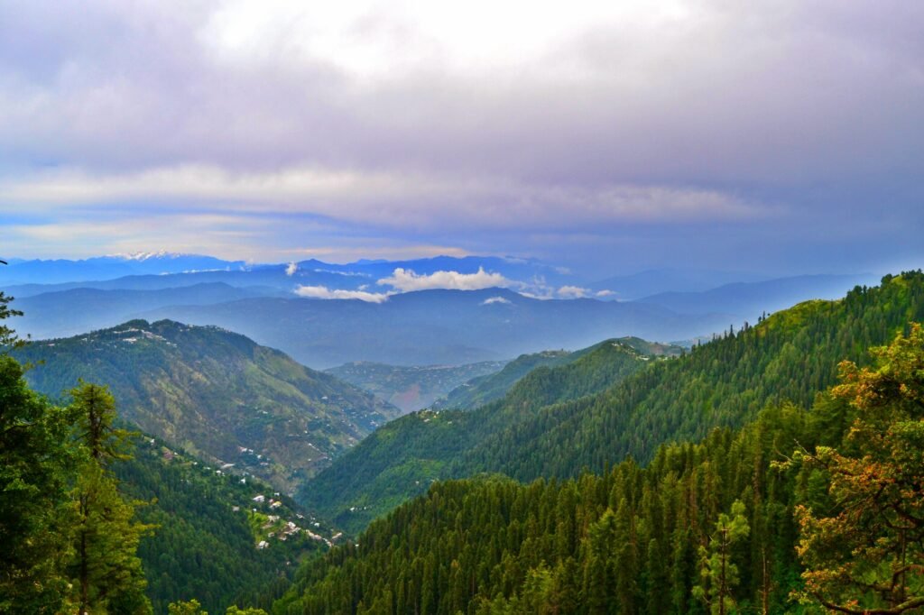
Viewpoints and Photography Spots
Mid-trail clearing (approximately 3 km from start): A natural opening in the forest canopy reveals the first significant valley views. This spot rewards with glimpses of the Galiyat ridge and hints of the plains far below. Perfect for first rest stop photography.
Ridge junction: As the trail gains the main ridge, views open dramatically in both directions. The Western Himalayan ranges become visible on clear days, and the landscape’s scale becomes suddenly apparent.
Summit plateau: The summit area offers 360-degree views that encompass:
- Nanga Parbat visible on exceptionally clear days (far northern horizon)
- Kashmir mountains to the northeast
- Islamabad and Rawalpindi visible in plains to the south
- Murree ridge extending westward
- Abbottabad valley descending eastward
Golden hour: Sunrise from the summit requires either overnight camping or an extremely early departure (around 3:00 AM from Islamabad). The reward—watching sunlight progressively illuminate the mountains from east to west while darkness still fills the valleys below—is extraordinary for photographers willing to make the effort.
Photography equipment recommendations: Wide-angle lens for summit panoramas, telephoto for wildlife and distant mountain detail, polarizing filter for reducing haze and enhancing sky contrast.
The Summit Experience
Standing on Miranjani’s summit for the first time creates a particular feeling that regular trekkers recognize, the combination of physical achievement, fresh mountain air, expansive views, and the simple satisfaction of having gotten yourself somewhere worth reaching.
The summit area is relatively flat and spacious, accommodating groups without crowding. A metal post or cairn marks the highest point, serving as the obligatory summit photo location.
What many visitors don’t anticipate is the wind. The summit’s exposed position channels significant breeze even on otherwise calm days. The temperature drop from Nathia Gali to the summit is typically 5-8°C, and wind chill extends that cooling further. Having a windproof layer in your pack seems unnecessary until it suddenly becomes essential.
The views’ clarity varies dramatically with conditions. Clear autumn days reveal mountain ranges that confirm exactly why this is the Galiyat’s highest point. Hazy summer days sometimes show little beyond the immediate ridge. The best views reliably occur in April-May (before summer haze) and September-October (after monsoon has cleared the atmosphere).
Allow at least 30-45 minutes at the summit, long enough to eat lunch, recover from the ascent, absorb the panorama, photograph properly, and rest before descent.
Weather at Miranjani Peak throughout the Year
Understanding Miranjani weather prevents the uncomfortable surprises that ruin otherwise well-planned hikes:
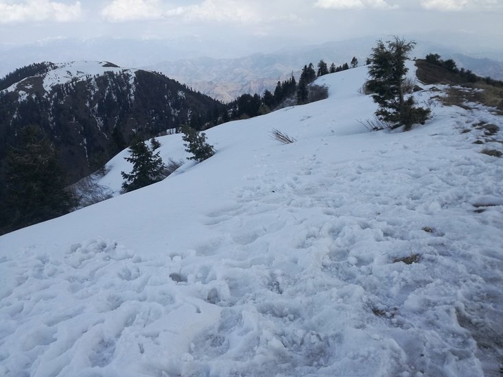
January-February: Cold (2-10°C at summit), frequent snow, ice on trail, short daylight hours, challenging but beautiful winter trekking
March-April: Warming (8-18°C), rhododendron blooming, excellent conditions building, occasional late winter snow possible
May-June: Pleasant to warm (15-25°C), green and lush, good visibility before summer haze, peak season approaching
July-August: Warm (18-28°C) with high humidity, monsoon rain frequent, trail muddy, occasional clear days offer good views
September: Cooling (15-25°C), post-monsoon clarity, excellent conditions
October-November: Cool to cold (5-18°C), exceptional clarity, autumn colors, falling leaf season
December: Cold (2-12°C), possible snow, quiet trails
Best Time to Visit Miranjani Peak
The best time to visit Miranjani divides into two excellent windows with different characters:
April-June (Spring/Early Summer): Spring represents many trekkers’ favorite Miranjani season. The rhododendron bloom (peaking in March-April) transforms the forest into something extraordinary, canopy blooms in red and pink above trails green with emerging vegetation. Temperature is ideal for comfortable hiking (not hot enough to exhaust, not cold enough to restrict). Bird activity peaks during breeding season, with species encounters at their best. Pre-monsoon clarity delivers good summit views.
September-October (Autumn): Post-monsoon autumn combines freshly washed atmospheric clarity (delivering the year’s best summit views) with comfortable temperatures and the particular beauty of autumn colors as oak and other deciduous trees change. Trails are dry and firm after monsoon’s end. Tourist crowds have reduced from summer peak. October specifically offers a combination of factors, temperature, clarity, color, and crowd levels, that makes it arguably the single best month.
Miranjani Trek in Summer
Summer (June-August) sees maximum tourist activity but mixed trekking conditions. The forest is its greenest, temperatures are comfortable relative to the plains (the primary reason families come), and trail infrastructure operates at full capacity. The downside: July-August monsoon brings frequent rain that makes trails muddy and slippery, reduces summit visibility, and occasionally makes the ridge section genuinely unpleasant. If visiting in summer, schedule departure for 6:00-7:00 AM before typical afternoon cloud buildup.
Miranjani Trek in Winter
Winter Miranjani trekking occupies a different category from other seasons, the mountain in snow is extraordinarily beautiful, the trail is quiet (sometimes entirely solitary), and the achievement of a winter summit feels considerably more substantial than summer equivalents. The requirements increase proportionally: appropriate winter footwear (microspikes often necessary on icy sections), layered cold-weather clothing, shorter daylight window, and realistic assessment of conditions before attempting. Checking recent trail conditions from Nathia Gali locals before committing to the summit is essential in December-February.
Also Read: Patriata Chair Lift & Cable Car Murree – Ticket Prices, Timings & Complete Guide
What to Pack for the Trek
Essential Hiking Gear Checklist
Footwear:
✅ Hiking boots with ankle support (genuinely essential; trail sneakers work but quality boots significantly improve comfort and safety)
✅ Spare socks (blister prevention)
✅ Gaiters for muddy or snowy conditions
Clothing:
✅ Moisture-wicking base layer
✅ Insulating mid-layer (fleece or light down)
✅ Windproof and waterproof outer layer
✅ Comfortable hiking trousers (avoid jeans, which are heavy when wet and restrictive when dry)
✅ Sun hat for exposed sections
✅ Warm hat for summit
✅ Gloves (essential even in spring/autumn for summit)
Navigation and safety:
✅ Downloaded offline maps (GPS track available from multiple sources)
✅ Fully charged power bank
✅ Headlamp with fresh batteries
✅ Basic first-aid kit
✅ Emergency whistle
✅ Trekking poles (optional but reduces knee strain on descent significantly)
Food and Water Availability

Trail availability: Zero. No food or water sources exist along the trail between Nathia Gali and the summit. Plan entirely on what you carry.
Carrying requirements:
- Water: Minimum 2 liters per person for summer, 1.5 liters for cooler seasons
- Food: High-energy snacks for trail consumption, lunch for summit
- Emergency rations: Extra snacks beyond planned consumption
In Nathia Gali: Numerous restaurants and cafés in the bazaar provide pre-trek breakfast and post-trek meals. The bazaar’s food scene is surprisingly good for a small hill station, proper Pakistani breakfast is readily available.
Summit: Some trekkers prefer eating lunch at the summit, the combination of physical hunger after sustained effort and panoramic views makes even simple food taste exceptional. Pack accordingly.
Camping Near Miranjani Peak
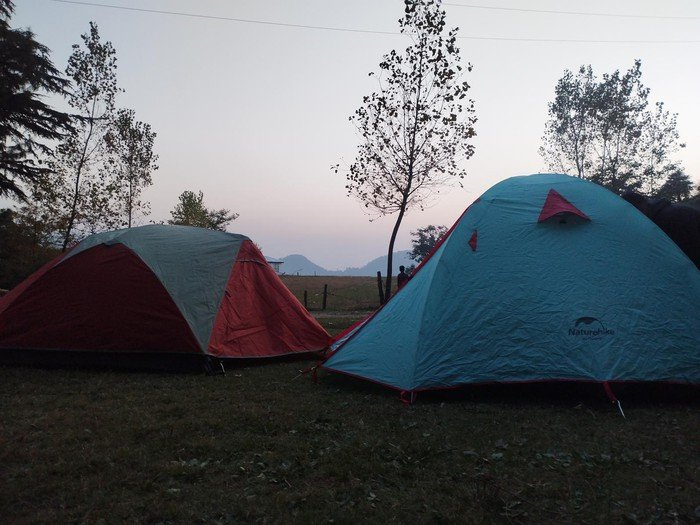
Overnight camping near Miranjani creates experiences distinctly different from day trekking, the summit at dawn, evenings watching light fade from mountain ranges, the profound quiet of protected forest at night.
Camping options:
Designated areas within Ayubia National Park: Camping requires prior written permission from the Ayubia National Park Wildlife Department. This process ensures park conservation and helps protect sensitive areas. Contact the Wildlife Department office in Nathia Gali to arrange permits well in advance.
Near the summit: Level areas near the summit provide camping options for those willing to carry gear the full distance. Wind exposure at this elevation means proper tent selection (a freestanding three-season tent minimum) is important.
Pre-summit areas: Sheltered spots within the forest offer better wind protection, though views don’t match the summit.
What to carry for overnight camping: Add to the day hike gear list: suitable three-season tent, sleeping bag rated to -5°C minimum, sleeping mat, cooking equipment and fuel, additional food, appropriate lighting.
Hotels and Accommodation Options
Nathia Gali offers diverse accommodation for all budgets:
Premium Options:
- Greens Hotel Nathia Gali: Well-maintained property with valley views, reliable hot water, comfortable rooms (PKR 8,000–15,000 per night as of 2026)
- Government rest houses: Various government-operated properties offering comfortable accommodation (advance booking essential, PKR 4,000–8,000 per night as of 2026)
Mid-Range Options: Multiple privately operated hotels and guesthouses offer clean rooms with basic amenities (PKR 3,000–6,000 per night as of 2026). Quality varies significantly; reading recent reviews is worthwhile.
Budget Options: Basic guesthouses in Nathia Gali provide simple accommodation for budget-conscious trekkers (PKR 1,500–3,000 per night as of 2026). Facilities are minimal but adequate for a pre-trek night’s rest.
Booking recommendation: Weekends in summer (June-August) see Nathia Gali fully booked by Thursday evening. Book accommodation a week ahead minimum for summer weekends. Midweek visits and shoulder season (April-May, September-October) allow more flexibility.
Eventica Travels partners with vetted Nathia Gali properties across all price ranges, offering confirmed bookings and quality assurance that online platforms don’t always provide.
Also Read: 10 Must-Visit Lakes in Pakistan
Safety Tips for Trekkers
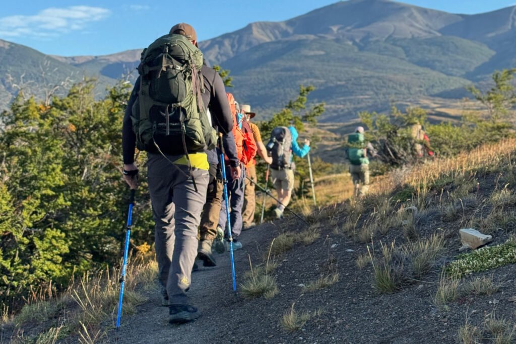
Never trek alone: The trail is generally busy during peak seasons, but accidents happen in quieter periods when help isn’t immediately available. Trekking with at least one companion is a minimum sensible precaution.
Register at the check post: This isn’t optional, it’s the system that enables search and rescue if something goes wrong. Your registration means someone knows you’re on the mountain.
Weather monitoring: Check forecasts the night before and morning of your trek. If significant rain is predicted (particularly in monsoon season), the summit view you’re working toward won’t exist. Rescheduling is almost always better than pushing through genuinely bad conditions.
Wildlife awareness: Bear encounters, while uncommon, occur in Ayubia. Make noise while hiking through dense forest (prevents surprising bears). If you encounter a bear at distance, stay calm, back away slowly without running, and make noise to alert it to your presence. Never approach wildlife for photographs.
Turn back criteria: Establish clear criteria before starting, if conditions worsen, if a group member struggles significantly, or if you haven’t reached the summit by a predetermined time (typically 1:00 PM to allow comfortable descent before dark), turn back without ego involvement.
Communication: Signal is available in Nathia Gali bazaar and in some trail sections but drops out in dense forest. Download offline maps, ensure someone not on the trek knows your plans.
Travel Costs and Budget Planning

Complete day trip budget per person from Islamabad:
| Expense | Cost (PKR) |
| Transport (public bus, return) | 600-800 |
| Transport (private vehicle, 4 people sharing) | 1,500-2,000 |
| Park entry fee | 100-200 |
| Guide (optional) | 500-1,000 |
| Food (Nathia Gali + packed lunch) | 800-1,500 |
| Miscellaneous | 300-500 |
| Total per person | 3,800-6,000 |
Overnight trip additional costs:
| Expense | Cost (PKR) |
| Accommodation (per night) | 2,000-8,000 |
| Additional meals | 1,000-2,000 |
| Total additional per person | 3,000-10,000 |
Miranjani remains one of Pakistan’s most economical genuine mountain experiences relative to the quality of what’s delivered.
Miranjani Peak for Beginners
If Miranjani is your first proper hike, here’s what nobody tells you in the standard guides:
The first kilometer doesn’t prepare you for how you’ll feel at kilometer three. The initial section through bazaar and park entrance is easy enough that beginners sometimes set a pace they can’t maintain. Start slower than feels necessary, you can always accelerate, and steady pacing makes the difference between enjoying and enduring the second half.
Your breathing will change. If you’ve only walked on flat surfaces, the sensation of sustained uphill affecting your breathing differently is unexpected. This is normal. Stop when needed, breathe deliberately, continue when ready. There’s no shame in frequent breaks, experienced trekkers use them strategically.
The descent is harder on your knees than the ascent is on your lungs. Trekking poles dramatically reduce this impact. If you don’t own poles, borrow or rent, it makes the difference between arriving at Nathia Gali feeling accomplished and arriving in pain.
Most importantly: beginners who attempt Miranjani with appropriate preparation consistently complete it successfully. It’s moderate, not extreme. Preparation and realistic expectations matter far more than natural athletic ability.
Family-Friendly Trekking Information
Miranjani with children is absolutely achievable with honest planning. I’ve watched families with kids aged 8-10 complete the summit and have genuinely excellent experiences. I’ve also watched poorly-planned family attempts create misery for everyone involved.
Age guidance:
- Under 6: Trail is too demanding for comfortable family experience. Ayubia National Park offers shorter walks more appropriate for young children.
- 6-10: Possible with slow pace, excellent preparation, and realistic time budgeting. Some children in this range absolutely excel.
- 10+: Should handle Miranjani well if reasonably active.
What makes family treks succeed:
The snack system is transformational. Children who are told “we’ll stop for snacks when we reach that big rock ahead” move with remarkable purpose. Use this.
Never tell children exactly how far remains. “We’re almost there” is acceptable hiking parenting. “We have three more kilometers” is not.
Build in genuine fun stops, a particularly interesting tree, a view clearing, a bird sighting, rather than making the summit the only acknowledged goal.
Leave significantly earlier than you think necessary. Family hikes in summer should begin at 6:30-7:00 AM before heat and crowds.
Nearby Attractions to Explore
Mukshkpuri Top
Often combined with Miranjani planning, Mukshpuri Top (2,787 meters) sits at the opposite end of the Ayubia ridge and is connected to the famous Pipeline Track, a forest walk of approximately 6 kilometers between Ayubia and Dungagali. The combination of Pipeline Track walking and Mukshpuri summit creates a different but equally rewarding alternative to Miranjani.
Nathia Gali
The hill station that serves as Miranjani’s base deserves exploration beyond its role as a trail head. Nathia Gali’s bazaar, colonial-era architecture, and relaxed pace represent authentic Galiyat hill station life. The Christ Church (established in colonial period), traditional bazaar, and viewpoints near town reward an hour of casual exploration.
Ayubia National Park
The park’s broader offerings extend well beyond the Miranjani trail. The Pipeline Track connecting multiple hill stations through protected forest is arguably the most famous trail in the Galiyat region, popular, scenic, and manageable for most fitness levels. The park’s Wildlife Department visitor center provides context about the park’s ecology and conservation significance.
Pipeline Track
The Pipeline Track follows a British-era water pipeline through dense forest between Ayubia and Nathia Gali, covering approximately 6 kilometers through exceptional forest. The track is gentler than the Miranjani trail and suitable for families with younger children, making it a perfect complement to a Miranjani-based trip.
Also Read: Attabad Lake Hunza Valley
Frequently Asked Questions About Miranjani Peak
Absolutely yes. Countless Islamabad residents make this a day trip. Depart Islamabad by 6:00-7:00 AM, begin hiking in Nathia Gali by 8:30-9:00 AM, summit by noon, return to Nathia Gali by 2:30-3:00 PM, back in Islamabad by 5:00-6:00 PM. It’s an excellent use of a single day.
Not strictly necessary for fit adults with map-reading confidence during busy seasons when the trail is well-populated. However, first-time visitors, families, and those less confident in navigation benefit from guides who know the trail, wildlife, and forest ecology intimately. Hiring a guide supports local economy and often genuinely enhances the experience.
Yes. A modest entry fee (PKR 100–200 per person as of 2026) is collected at the check post entrance. Fees support park conservation and are well worth the cost.
During December–February, snow is common on the summit and upper trail sections. Late March and early April sometimes retain snow patches. The mountain in snow is genuinely beautiful but requires proper winter footwear and cold-weather gear.
The trail is generally safe with reasonable precautions. It’s a public, well-frequented trail during peak seasons. Inform someone of your plans, hike during daylight hours, and ideally join a group or hire a guide if trekking independently. Many solo female trekkers have excellent experiences at Miranjani.
Realistically: various bird species (particularly on morning hikes), barking deer (heard more than seen), various lizards, and possibly yellow-throated marten. Bear and leopard sightings are possible but uncommon for most hikers. The birding experience alone often surprises visitors with its richness.
Final Thoughts
Miranjani Peak occupies a particular place in Pakistani trekking, accessible enough for beginners to complete successfully, rewarding enough for experienced trekkers to return repeatedly, and located close enough to Islamabad that it requires minimal logistical complexity to enjoy.
The combination of protected forest, genuine summit views, diverse wildlife, and the particular satisfaction of reaching the Galiyat’s highest point creates experiences that regularly exceed expectations. First-time trekkers discover they’re capable of more than they imagined. Experienced trekkers find views and forest quality that justify repeated visits across different seasons.
2026 is a great year to discover Miranjani. The trail infrastructure continues improving, Nathia Gali’s accommodation scene is evolving, and the protected status of Ayubia National Park continues preserving the ecological quality that makes the trek so special.
Whether you’re a beginner taking your first proper mountain hike, a parent introducing children to trekking, a photographer seeking summit panoramas, or an Islamabad resident wanting genuine wilderness without multi-day travel, Miranjani delivers. Set an early alarm, lace up your boots, and let Miranjani’s trail do what it’s been doing for generations of Pakistani trekkers: inspiring, challenging, and rewarding in exactly the right proportions.
Plan Your Miranjani Trek with Eventica Travels
Ready to experience the Galiyat’s highest peak with expert guidance and complete support? Eventica Travels offers guided Miranjani Trek experiences that handle every detail, from Islamabad transport and Nathia Gali accommodation to knowledgeable trail guides and photography support.
Our Miranjani guides know this mountain in every season, every weather condition, and every photographic angle. They’re not just guides, they’re enthusiasts who genuinely love this forest and want you to experience it at its best.
📞 Contact Eventica Travels Today
📧 Email: treks@eventica.com
🌐 Website: www.eventicatravels.com
📱 WhatsApp: +92-XXX-XXXXXXX
☎️ Call: +92-XXX-XXXXXXX
Office Hours: Monday-Saturday, 9:00 AM – 6:00 PM
WhatsApp: 24/7 for trek inquiries and bookings
🎁 2026 Early Season Special:
Book any Miranjani package before April 30th, 2026 and receive:
- ✨ 10% discount on package price
- ✨ Complimentary trail photography guide
- ✨ Free rhododendron season timing consultation
- ✨ Post-trek Nathia Gali restaurant recommendations
Limited weekend departure spots are available; book early to secure preferred dates during peak rhododendron season (March-April) and autumn clarity season (September-October)!
Eventica Travels – Your Gateway to Pakistan’s Mountain Experiences
“Every summit starts with a single step from a trailhead. Let us help you take that step in the right direction.”


